Mapping the physical world with mobile intelligence.
We build mobile-first GIS, mapping and AI-powered tools for people who work with land, location and real-world data.
- Founded
- 2024
- Live products
- 01
- Focus
- Mobile GIS
- Based in
- Istanbul
Your whole field toolkit, free on your phone.
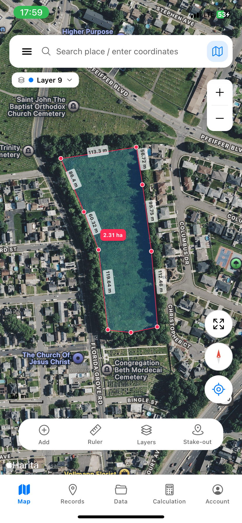
MapLab Survey turns your phone into a field-grade GIS: draw and measure, RTK/GNSS points, 35+ coordinate systems, cut-and-fill, parcel query and export to DXF, KML, Shapefile, GeoPackage and more — most of it offline.
Tools built for the field.
A small catalog, growing carefully. Each app does one job well, on the phone in your pocket.
MapLab Survey
Mobile GIS measurement. Draw, measure and export field-grade geometry. KML, KMZ, DXF, GeoJSON, CSV.
View productEarth Shift
Drag countries across a Web Mercator map and see projection distortion live. Episode 01 of the Atlas project.
Open and tryMapLab Atlas
Cartography literacy, told in interactive stories. Episode 01, Earth Shift, is live.
Concept liveMapLab Vision
AI for aerial and satellite imagery. Detect parcels, classify terrain and extract features on-device.
Coming soonMapLab Field
AI co-pilot for surveyors. Voice-to-survey, smart snap, auto-CRS detection and on-device terrain reasoning.
Coming soonWhat we believe.
Three principles we apply to every product, every release.
Mobile-first
Real surveying happens in fields, on rooftops, beside highways. Our software is designed for the phone first, touch, sun, gloves, no signal, and the desktop only when it makes the work better.
Reaching the map, taking a measurement, recording and sharing the data, it should all be just a few taps away.
Honest GIS
We respect precision. Every coordinate keeps its CRS. Every measurement shows its accuracy. No marketing math, no rounded magic, just the numbers, traceable end-to-end.
No unnecessary complexity, just a fast, clear and dependable workflow.
Applied AI
Useful intelligence beats clever demos. We ship AI when it removes work, auto-snap, layer suggestion, terrain extraction, never as a novelty layered on top.
AI is used for layer detection, automatic classification, data extraction and speeding up fieldwork, to make the work easier, not for show.
A small, independent studio for serious geospatial software.
MapLab Tech is a focused team of engineers and surveyors building software for the people who measure, map and shape the physical world. We work on mobile GIS, mapping and AI-powered field tools.
We work independently and move quickly. We read every message and reply as directly as we can.
We build and ship the software we use ourselves. Most of the time we decide what to build next together with the people working in the field.
Have a problem to solve in the field?
We work with surveyors, civil engineers and field teams on custom mobile GIS tooling. Tell us what you're measuring.
maplabtech@gmail.com